
- Snow has forced the closure of several schools and highways as wild, wintry weather blasts the country.
大雪迫使几所学校和高速公路关闭,因为狂野的冬季天气席卷了这个国家。 - Auckland is in the firing line this afternoon with strong 100km/h gusts forecast to strike during rush hour.
奥克兰今天下午处于火线,预计高峰时段将有 100 公里/小时的强阵风。 - MetService has placed multiple snow, wind and road warnings across the country.
MetService 已在全国范围内发出多个降雪、风和道路警告。
Power is out to some 22,000 properties across the Coromandel Pensiula as the top of the country braces for severe 100 km/h wind gusts and possible hail.
【澳纽网编译】科罗曼德 Pensiula 的约 22,000 处房产已停电,因为该国顶部准备迎接 100 公里/小时的严重阵风和可能的冰雹。
广告 | Advertisement
在澳纽网做广告 | Advertise with us

The widespread fault hit the region around lunchtime.
大面积的断电在午餐时间袭击了该地区。
Powerco said it was working quickly and safely to make repairs and restore electricity to all affected customers.
Powerco 表示,它正在迅速安全地为所有受影响的客户进行维修和恢复供电。
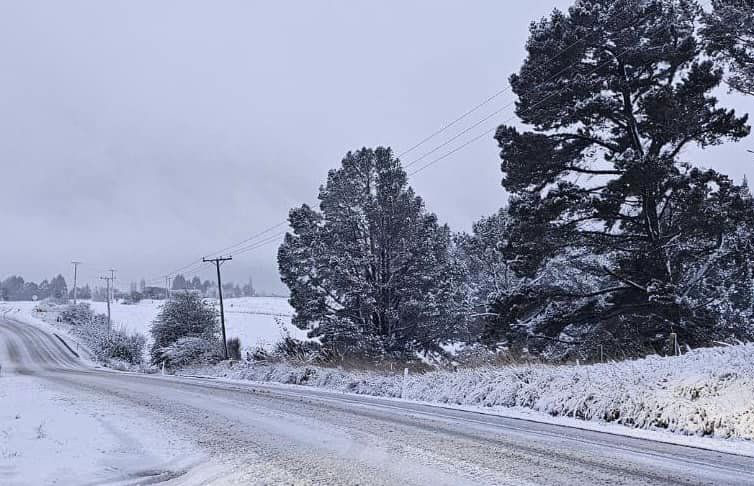
Wintry weather has hit the south with thick snow closing highways and several schools.
寒冷的天气袭击了南部,厚厚的积雪使高速公路和几所学校关闭了。
Invercargill MP Penny Simmonds called the weather “brutal” following the dumping of snow in her region and said several primary schools and highways had been forced to close.
因弗卡吉尔议员彭妮·西蒙兹 (Penny Simmonds) 称她所在地区倾倒积雪后的天气“残酷”,并表示几所小学和高速公路已被迫关闭。
Earlier, a section of Lindis Pass (SH8) and SH93 from Matarua to Clinton closed due to icy conditions, but has since reopened.
早些时候,从马塔鲁瓦到克林顿的林迪斯隘口 (SH8) 和 SH93 路段因结冰而关闭,但此后已重新开放。
Further north, SH8 Fairlie to Tekapo is closed.
再往北,开往 Tekapo 的 SH8 Fairlie 已关闭。
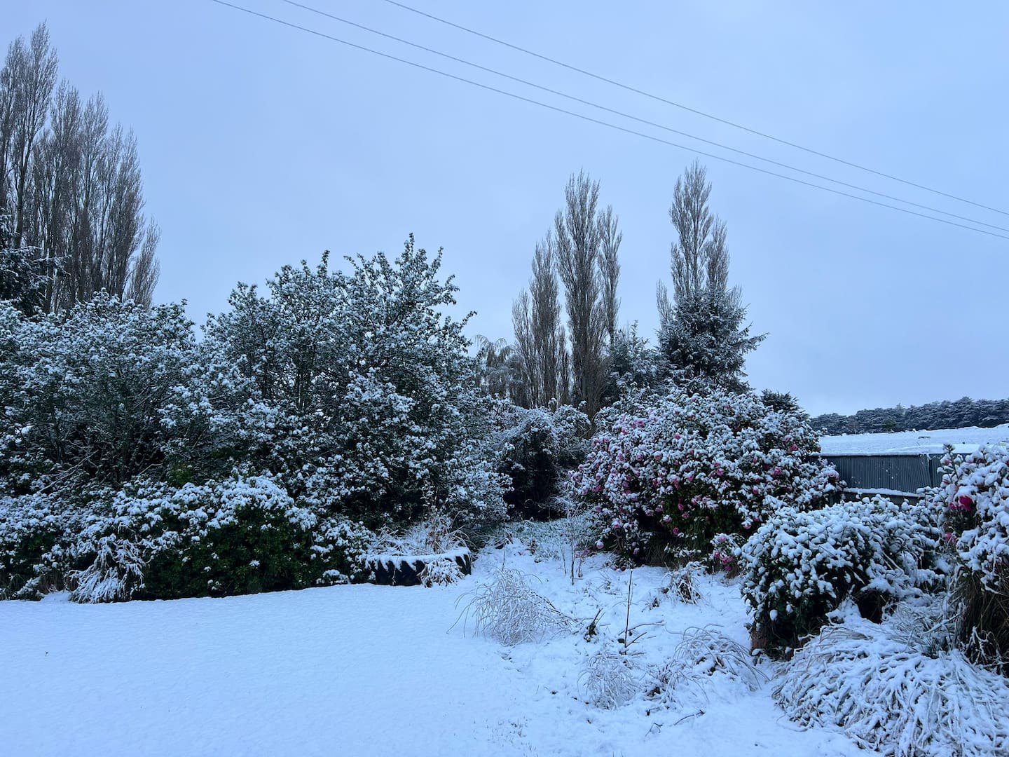
今天早上,戈尔降雪量约为 2 厘米。图 / 戈尔区议会
In Wānaka, residents reported snow falling on the lakefront at midday.
在瓦纳卡,居民报告说中午湖边下雪了。
广告 | Advertisement
在澳纽网做广告 | Advertise with us
Meanwhile, Aucklanders are being urged to brace for power outages and to take care driving with heavy rain, strong gales and possible hail due at rush hour.
与此同时,敦促奥克兰人为停电做好准备,并在高峰时段大雨、强风和可能的冰雹中小心驾驶。
A strong wind watch is in place for Northland from Whangārei, Auckland, Great Barrier Island and Coromandel Peninsula from 4pm. MetService is warning wind may approach “severe gales” in some places. Niwa is warning gusts of more than 100km/h could roar through the north this afternoon.
从下午 4 点开始,从旺格雷、奥克兰、大屏障岛和科罗曼德半岛的北部地区已发布强风预警。MetService 警告说,一些地方的风可能会接近“强风”。丹羽警告说,今天下午可能会有超过 100 公里/小时的阵风席卷北部。
NZ Transport Agency Waka Kotahi (NZTA) is asking motorists using the Auckland Harbour Bridge to take extra care, with strong gusts expected until 9pm.
新西兰交通局 Waka Kotahi (NZTA) 要求使用奥克兰海港大桥的驾车者格外小心,预计强阵风将持续到晚上 9 点。
There are also warnings of thunderstorms and small hail.
还有雷暴和小冰雹的警告。
Vector is also warning strong winds could bring power outages, with areas likely most affected by gusty winds set to include the west coast, Warkworth and Wellsford.
Vector 还警告说,强风可能会导致停电,受阵风影响最大的地区可能包括西海岸、沃克沃斯和韦尔斯福德。
There is also a moderate risk of thunderstorms in Bay of Plenty, including Rotorua, Gisborne, Taupō and Hawke’s Bay. These storms may continue along the coast of Gisborne and the Mahia Peninsula into the evening, potentially bringing heavy rain (10 to 15mm/h) and small hail.
丰盛湾也有中等程度的雷暴风险,包括罗托鲁瓦、吉斯本、陶波和霍克斯湾。这些风暴可能会沿着吉斯本海岸和马希亚半岛持续到傍晚,可能会带来大雨(10 至 15 毫米/小时)和小冰雹。
MetService has issued multiple road snowfall watches and warnings around New Zealand, including the Napier-Taupō Rd (SH5) and the Desert Rd (SH1), where up to 10cm could fall in areas above 700m.
MetService 已在新西兰各地发布了多个道路降雪预警和警告,包括 Napier-Taupō Rd (SH5) 和 Desert Rd (SH1),在 700 米以上的地区,降雪量可能高达 10 厘米。
There is also a road snowfall warning for the Remutaka Hill Rd (SH2), where rain could turn to snow above 400m.
Remutaka Hill Rd (SH2) 也有道路降雪警告,那里的雨可能会在 400m 以上变成雪。
广告
Advertise with us
In the South Island, road snowfall warnings have been issued for Lewis Pass (SH7), Porters Pass, Arthur’s Pass (SH73), the Crown Range Road and Milford Road (SH94).
在南岛,刘易斯隘口 (SH7)、波特斯隘口、亚瑟隘口 (SH73)、皇冠山脉路和米尔福德路 (SH94) 已发布道路降雪警告。
There is also a heavy snow watch over Taihape, where snow is expected to lower to around 600m.
Taihape 上也有大雪预警,预计那里的积雪将降至 600 米左右。
Niwa forecaster Ben Noll said the wintry weather could be described as “the last hurrah” of a rare polar heatwave over Antarctica that had been strengthening low-pressure systems to the south of New Zealand.
丹羽预报员本·诺尔 (Ben Noll) 表示,寒冷的天气可以被描述为南极洲罕见的极地热浪的“最后欢呼”,该热浪一直在加强新西兰南部的低压系统。
But sunnier days were on the cards for the weeks ahead.
但未来几周阳光明媚的日子即将到来。
“The good news is that high pressure will become much more abundant in the New Zealand region starting next week,” Noll said.
“好消息是,从下周开始,新西兰地区的高压将变得更加丰富,”诺尔说。
Niwa has given 50-50 odds of a La Nina climate pattern forming up by the end of spring – along with an earlier-than-usual shift to summer-like weather later in the season.
丹羽认为,拉尼娜气候模式在春末形成的可能性为 50-50,同时在春末阶段会比平时更早地转变为类似夏季的天气。
来源:NZ Herald
分类: 澳纽资讯
(即时多来源) 新西兰英语新闻 New Zealand English News
广告 | Advertisement
在澳纽网做广告 | Advertise with us
163 views